Same Belt, Separate Earthquakes: How to Read the Ring of Fire
Whenever two large earthquakes land in the same week, the same claim goes around: the Ring of Fire is waking up, and something bigger is coming. It is worth knowing why seismologists do not read it that way.
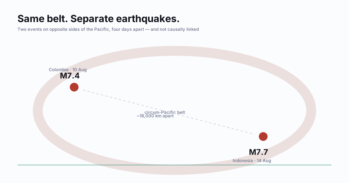
Quick answer. Two large earthquakes close together in time are not evidence that one triggered the other. USGS states that earthquakes thousands of miles apart are generally not causally linked. About 81% of the world’s largest earthquakes happen along the circum-Pacific belt, so coincidences there are ordinary. Nobody can predict the time, place and magnitude of a major quake — which is why preparation, not prediction, is the useful response.
The belt is a place, not a mechanism
The “Ring of Fire” is a name for the plate boundaries encircling the Pacific. It is a description of where earthquakes and volcanoes cluster, not a connected system that fires in sequence. USGS puts roughly 81% of the planet’s largest earthquakes along this circum-Pacific seismic belt.
That single statistic explains most of what looks like a pattern. If the large majority of big earthquakes occur along one belt, then any two large earthquakes will usually both be on that belt. Finding them there is not a signal. It is the base rate.
A worked example, using two real events
Two recent earthquakes make the point concretely. They are separate, unrelated events, and are described here only as examples of how far apart “same belt” can be.
- M7.4, Colombia — 5 km south of San José del Palmar, 10 August 2026 at 12:34 UTC, about 110 km deep. USGS issued a red PAGER alert.
- M7.7, Indonesia — 68 km north-north-west of Ende, 14 August 2026 at 21:58 UTC, about 10 km deep. USGS issued a yellow PAGER alert.
They are four days and roughly 18,000 kilometres apart, on opposite sides of the Pacific, at very different depths. Nothing about that pairing implies a shared cause — and the PAGER colours show why depth and location matter more than magnitude alone: the smaller of the two carried the more severe alert, because a deep quake beneath populated terrain can shake people harder than a larger one elsewhere.
That is the useful lesson hiding inside the scary headline. Magnitude is not impact.
Nobody predicted these, and nobody could have
Scientists can map long-term hazard, and they can issue aftershock forecasts once a sequence has begun. What they cannot do is state the exact time, place and magnitude of a major earthquake before it happens. USGS is direct about this: no scientist has ever predicted a major earthquake, and they do not expect to any time in the foreseeable future.
So treat any account promising a dated forecast as entertainment at best. A countdown is not information.
Your risk is local, and mostly boring
A world map covered in dots tells you almost nothing about your own situation. Four local factors do:
- The building you are in — its construction, age and code history.
- The ground under it — soft soil and fill amplify shaking.
- Your distance from an active fault.
- Whether you are near a coast, which adds tsunami exposure.
None of those change because an earthquake happened on another continent. All of them can be acted on this week.
What to do instead of watching the map
During shaking, in almost every indoor case: Drop, Cover, and Hold On. Get low, protect your head and neck under sturdy cover, and hold on. If you are indoors, stay indoors until it stops.
Near the coast, add one step. Once shaking stops, strong or long shaking is itself a natural tsunami warning — move inland or to higher ground without waiting for a phone alert, because a nearby tsunami can arrive first.
Then do the unglamorous part: anchor the furniture that can fall on someone, store water, agree a reunion point, and keep shoes and a light beside the bed. It is a worse story than a global chain reaction, and it is the part that actually helps.
| Do | Avoid |
|---|---|
| Read the base rate — most big quakes are on this belt | Treating “both on the Ring of Fire” as a link |
| Judge impact by depth, location and buildings | Judging impact by magnitude alone |
| Use official hazard maps and alerts | Viral countdowns and dated predictions |
| Fix your own building, ground and coast risk | Watching a world map of dots |
| Practise Drop, Cover, and Hold On | Waiting to see whether “something bigger” comes |
Why the same belt produces different disasters
The Ring of Fire is a single name for several different mechanics, which is why comparing two of its earthquakes rarely tells you much. At a subduction zone, where one plate is forced under another, the fault surface is enormous and shallow-dipping — that geometry is what produces the largest magnitudes and, because it displaces the sea floor vertically, the tsunamis. At a transform boundary, where plates grind past each other sideways, the same belt produces earthquakes that can be very destructive locally while displacing almost no water at all.
So the useful question about an event is never just its magnitude. It is what kind of boundary moved, how deep it was, and whether the sea floor went up or down. Two magnitude-7 earthquakes on the same belt can mean a tsunami warning for a whole ocean or a strictly local emergency.
Depth is why a smaller number can do more damage
A shallow earthquake delivers its energy into a much smaller area of ground than a deep one, so a magnitude 6.5 at 10 kilometres can be far more damaging locally than a magnitude 7.5 at 200 kilometres. This is the single most common reason a headline number seems not to match the pictures. It is also why the depth figure sits next to the magnitude in every official report — it is not trivia, it is half the story.
What the magnitude scale actually says
The scale is logarithmic, and the two ratios are worth carrying around because they make the numbers legible. One step up — 6 to 7 — is about ten times the ground motion and roughly thirty-two times the energy. Two steps is about a thousand times the energy. That is why the difference between a 6 and an 8 is not "somewhat worse", and why a run of small tremors does not relieve anything: it would take a very large number of magnitude-4s to release what one magnitude-7 releases, so the popular idea that small quakes are "letting off pressure" is arithmetic that does not work.
What preparation actually looks like here
Because the belt is a place rather than a schedule, everything useful is local and dull: knowing whether your building was built to a modern seismic code, securing the furniture that can fall on someone, and having water and shoes where you can reach them in the dark. Our guides to the first sixty seconds and the natural tsunami warnings are the two things worth reading before an event; nothing on a live map is.
Sources
- USGS — Where do earthquakes occur?
- USGS — Earthquake facts and earthquake fantasy
- USGS — Can you predict earthquakes?
- USGS — M7.4 Colombia event page
- USGS — M7.7 Indonesia event page
- CDC — Earthquake safety
This guide restates official preparedness guidance. It is not medical, structural, or emergency advice for your specific situation — follow the instructions of local authorities during an actual event.